The primary intent of Automatic Identification Systems (AIS) is to aid in the avoidance of vessel collisions by providing positional data (latitude and longitude) and attributes (such as speed, name, size, type, etc.) of equipped vessels. AIS plays an increasingly important role in enhancing the Maritime Domain Awareness of many countries around the world.
AIS allows the automatic exchange of real-time vessel movement data, including static and voyage-related information, between ships or between ships and shore stations.
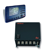
An example of an AIS transponder |
A Class B AIS transponder 
An example of an AIS base station |
- Vessel Name
- International Maritime Organization (IMO) Number
- Maritime Mobile Service Identity (MMSI) Number
- Vessel Call Sign
- Length, Beam, Draft
- Vessel Type
- Ship Position (Latitude & Longitude)
- Speed Over Ground (SOG)
- Course Over Ground (COG)
- Heading
- Rate of Turn (ROT)
- Estimated Time of Arrival
For additional information about AIS, please visit these websites: